September 25, 1981-Friday: Day 30 New Pacific Coast Adventure
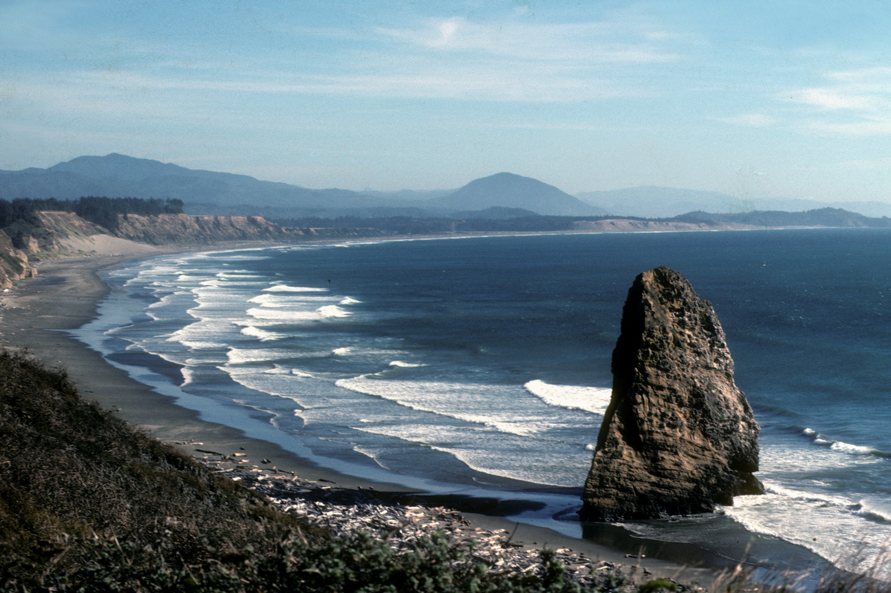
I got some tea at the Happy Harbor then did a painting of Chief Kiwanda Rock that was offshore from my nightspot. A note here as I am once again writing these posts from my skimpy log book entries and my skimpier memories, trying to refresh it with google maps and google earth I am amazed by how much things have changed. What was a peaceful and quiet spot somewhat isolated has become a tremendously overbuilt area and is hard to find some of the spots I visited so many years ago.
There were a couple of businesses and a motel across the street. When I talked to my cousin some time later she said she had stayed at that motel with her mother and young neice who was in the movie Kindergarten Cop with Arnold Schwarzenegger that was being filmed on location nearby.
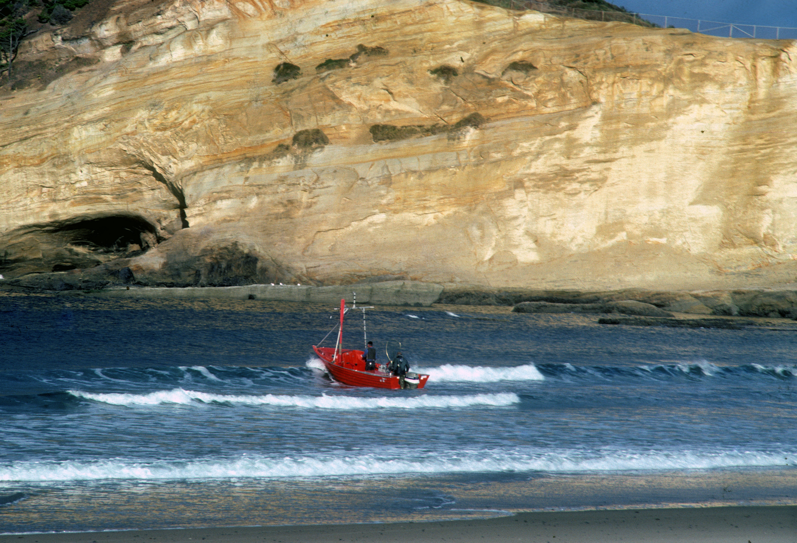
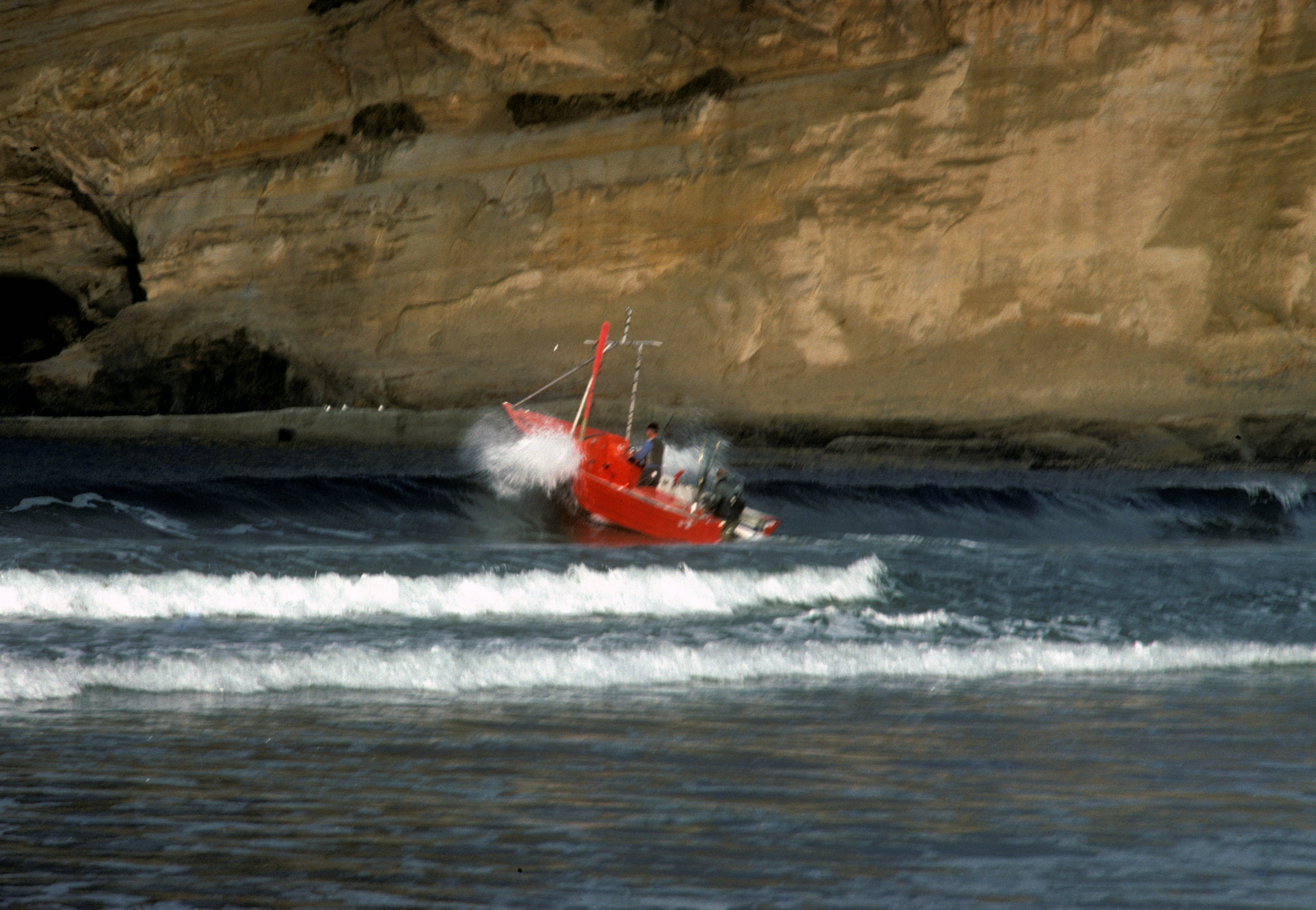
Something I read about the place when I was there is that it is the last place in the United States where the dory fishing boats still launched from the beach through the surf and I was able to see them do that during the morning I was there. I checked on youtube to see if there were any videos of it and it looks like they are still doing it. When I saw those videos I also saw one of a drone go off shore by the rock and when it turned around I was amazed by how much the area was built up now.
12:50 and it was time to move on south. Hit the Safeway in Lincoln City and then stopped at the Roads End Wayside for lunch. Next I hiked up to the point on the north end. Going south again I stopped at the Red River Wayside and then on to a spot by the inlet bridge where I parked for the night. Another walk to the beach and the pier and treated myself to a malted shake at the Dairy Queen.
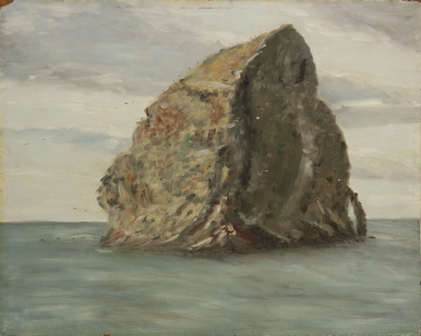
#190 Chief Kiwanda Rock 16x20
Dory Boat Headed Out
#408 Dory Boat Heading Out through Surf 16x20: A painting I did later from the photo
September 26, 1981-Saturday: Day 31 More Coast and Auto Maintenance
After breakfast at the Pines Restaurant, a Mexican omelet and tea for $4.25 I did a painting of 4 outcroppings in the inlet.
#191 Rock Outcroppings-Lincoln City 12x16
I was often stopping at any ocean viewpoints because I wanted to see as much of the coast as I could, so as I headed south again I made a stop at the Gleneden Beach Wayside and then on to Boiling Bay State Park (there may be problems with the way I recorded the names of place I stopped or maybe there have been changes over the yesrs but on the current map this appears to be called Boiler Bay Scenic Viewpoint).
Anyway it was time for some auto maintenance - replaced the points and condensor and adjusted the carburator and vacuum hose. I left to adjust the timing and about a mile down the road I pulled over along the roadside off of 101 in Depoe Bay where there was a nice view of the cove. For a change of pace I stopped at a bookstore on Ellington Street and bought a first edition of Jack Kerouc's "Town and the City".
On to Devil's Punchbowl State Park, then to Agate Beach where I collected a bunch of clear rocks but don't know whether they are agates or not. Just past 7:00 pm I reached Seal Rock State Park, with running water in the bathroom I was able to get a washcloth bath and shampoo my hair.
Final stop for the day was in Waldport on the inlet behind the Waldport Brewers Tavern. It's hard to makeout but it looks like I got three draft beers for $1.20 and I don't know whether it's the price of the beers or the fact that I didn't usually drink that much to question what it was I got. It was a full day and I only covered 43.3 miles.
September 27, 1981-Sunday: Day 32 Pass on the Sea Lion Caves and Amazing Coincidence
First stop was Yachats Beach State Park, it was raining but I was able to park with a view of the ocean and coastal rocks and did a painting looking through my window.
Mid afternoon I headed on south and my next stop, Carl G. Washburne State Park. Following the coast I got a photo of the Heceta Head Lighthouse.
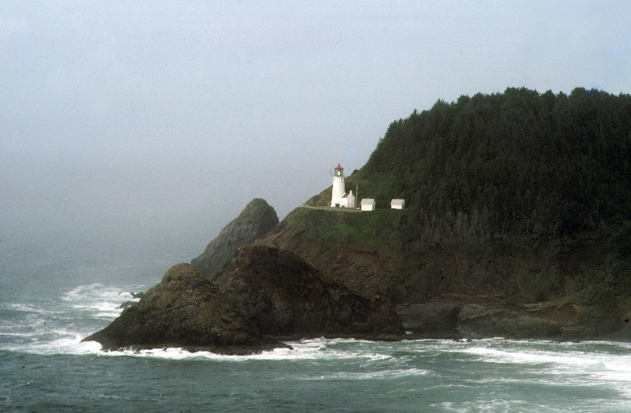
I stopped at the Sea Lion Caves but they wanted an outrageous price to see the caves so I passed on that. At 4:01 I stopped at the Florance Taco Time restaurant and one of the most amazing coincidences of the trip happened there. The couple and girl I had met at the Big Horn Campground in Wyoming two weeks ago were in the restaurant on the way north on their west coast trip. After saying hello I had a soft burrito and Dr. Pepper ($1.83) then headed to the Florence Old Town section and walked around for a while. My next state park of the day was the Jesse M Honeyman Memorial State Park which is by the Oregon Sand Dunes area.
After spending a little over a half hour checking this area out I continued on to Reedsport stopping at the China Doll for some chinese food and then just south of the town by the side of Route 1 for the night. End of an interesting day-covering 62.4 miles
After spending a little over a half hour checking this area out I continued on to Reedsport stopping at the China Doll for some chinese food and then just south of the town by the side of Route 1 for the night. End of an interesting day-covering 62.4 miles
September 28, 1981-Monday: Day 33 More Ocean and Rare Bar Stop
I left my night spot a little before 9:00 am and stopped about 4 miles south at the Douglas County Park south jetty. I spent the morning painting a picture of a field and lighthouse here. I can see now it is called the Umqua River Lighthouse. The scene seems to have changed quite a lot since I have been there.
Heceta Head Lighthouse
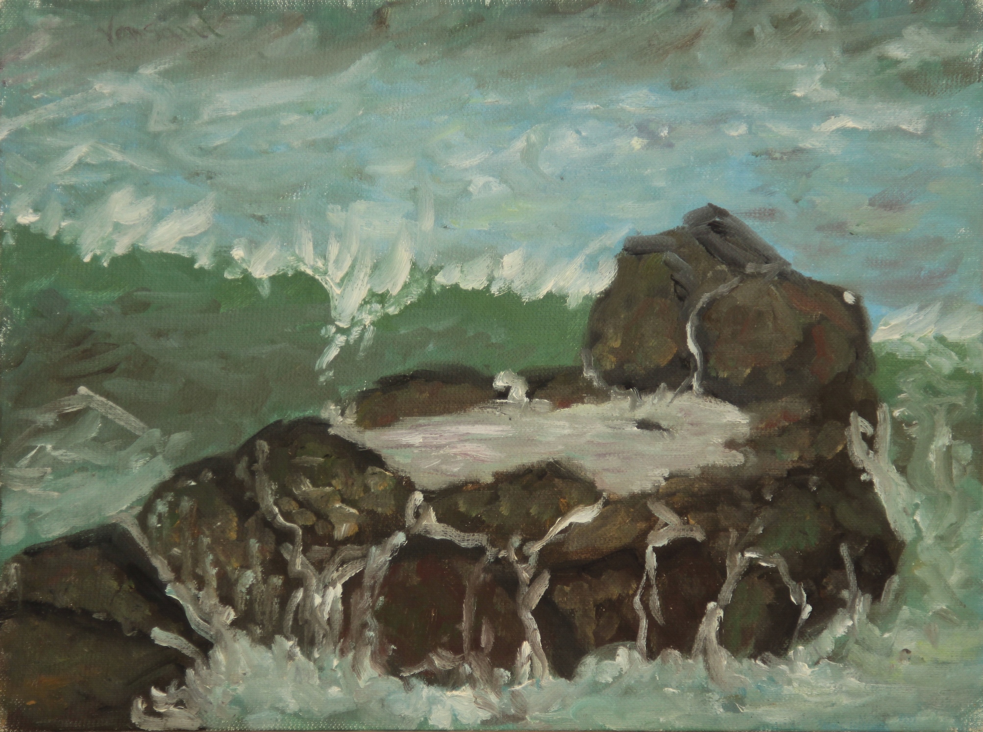
#192 Surf Rocks, Yachats Beach 12x16
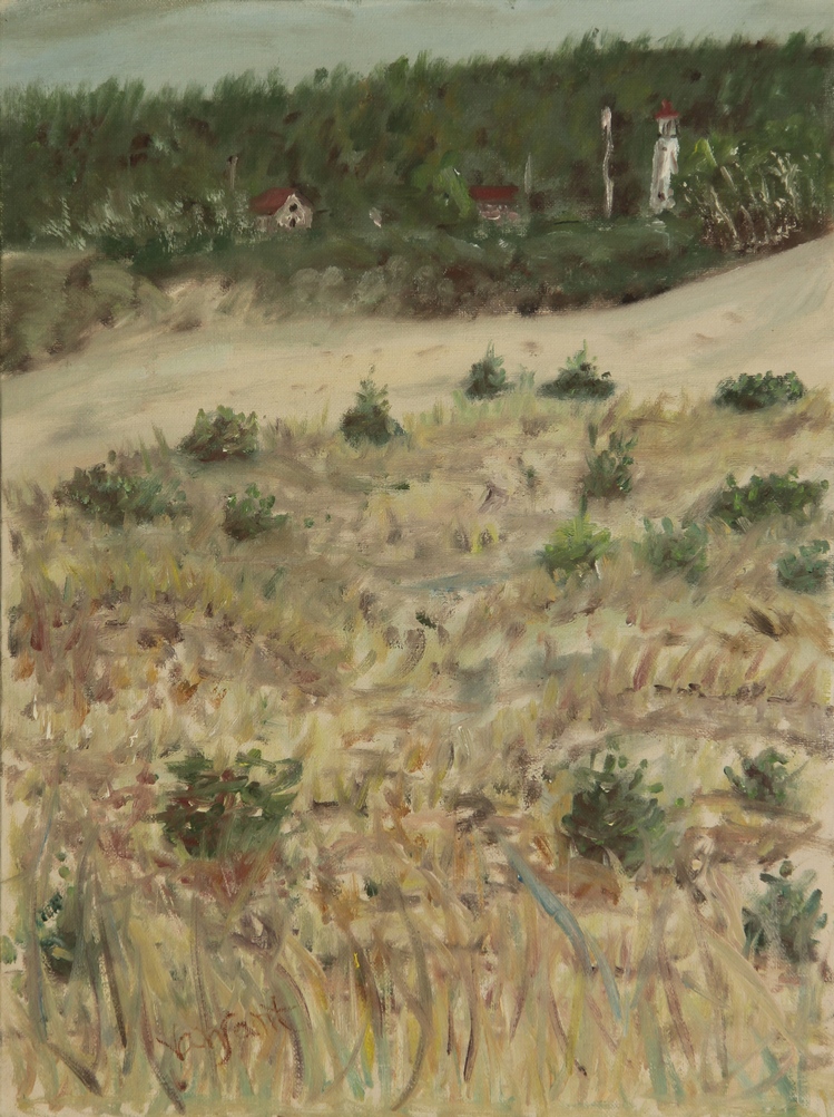
#193 Field and Lighthouse near Winchester, Oregon 16x12
Later that day I got gas for the first time in Oregon and it was kind of strange becuase it is against the law to pump your own gas supposedly because of the enviromental danger this posed. $125.9 for 88 octane at a Coos Bay Franko station. Next I did some more donut store research at Taylor Maid donuts down the street. Donut .30, coffee .35 and splurged on an apple fritter for .50. I did some more shoping at some other stores in Coos Bay, a local map from the Chamber of Commerce, sent a postcard from the local Post Office, s sketch book from the Frame Stop near Central and 4th and finally shampoo and candy from a Payless Drugs. Before leaving town I got a burrito supreme from Taco Bell and then onto Sunset Cliffs State Park where I took some photographs and took a cold shower at the beach facility.
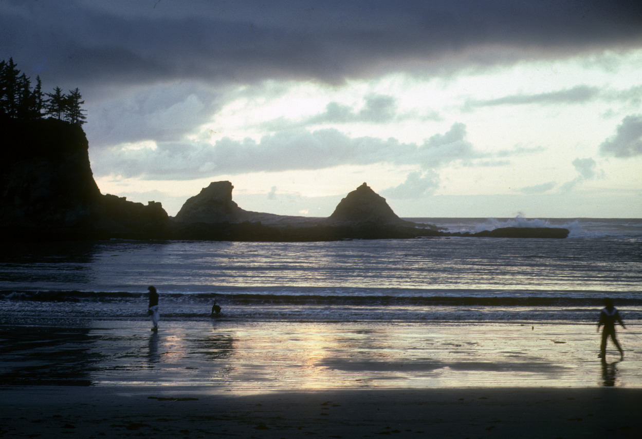
Sunset Cliffs State Park
The park closed at sunset so I moved down the road some and arranged some things in the van. Then I went to the Charleston Boat Basin and stopped at the Basin Cafe. I planned to stay up to 11:00 pm so I could use the phone at the cheap rates and call home. While I was waiting I had 3 draft beers for $1.50 then I made my call and ended up staying at a scenic viewpoint off of 1 between Shore Acres State Park and Cape Arago State Park.
September 29, 1981-Tuesday: Day 34 Historic Coastal Estate
At 10:21 I left my night spot and went a short distance back up the road to Shore Acres Botanical Garden. I see they charge for parking now but apparently not back then, from pictures seems to be much more developed now. This was originally the estate of a lumber baron whose house had burnt down many years before but the state had restored the gardens. This was where I became first aware of dahlias as the garden had wuite a few real dinner plate sizes (as they loosely call a lot of them but they don't approach the sizes of the ones that were here. There were yellow and violet blooming bushes. A really impressive and beautiful site overlooking the ocean.
Went to Sunset Beach State Park again and then on south to Seven Devils State Park where I took time to shave and trim my hair. A little after three I arrived at Bullards Beach State Park and stopped by the lighthouse. There I did a painting of the lighthouse. I called it the Bandon Lighthouse but I see on my current map it is called the Couquille River lighthouse but why change now?
Went to Sunset Beach State Park again and then on south to Seven Devils State Park where I took time to shave and trim my hair. A little after three I arrived at Bullards Beach State Park and stopped by the lighthouse. There I did a painting of the lighthouse. I called it the Bandon Lighthouse but I see on my current map it is called the Couquille River lighthouse but why change now?
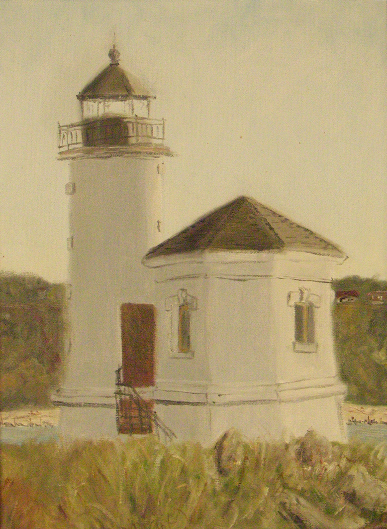
#194 Bandon Lighthouse, 16x12
After leaving there it was time to eat dinner and I stopped in Bandon at Frasers Restaurant. Eggs and toast with tea and ice cream for desert with tip came to a total of $2.65 for the meal and expenses for the day. What a day it had been. I parked for the night down near the beach and inlet.
September 30, 1981-Wednesday: Day 35 Bandon
I spent a good part of the day doing things around Bandon. I first went to Bucks Sentry Market for some groceries then to the post office for 2 stampd and 2 post cards. Then I went and parked at the small boat basin and did a 12x16 painting of an old building on the pier but I don't have a photo of it but I did see in my record book that I sold it along with the Bandon Lighthouse to my cousin. After I finished the painting I walked around town and a short distance away I stopped at the Minute Cafe for a coffee and butterbun-$1.00. Surprisingly when I did a searh for it, it is still there. To continue my sightseeing in Bandon I went to the south jetty and then a short way down the coast to the Face Rock Wayside.
About 3:03 I left Bandon and followed 101 south which left the coastal view and when I got close to Cape Blanco I decided to go take a look.
About 3:03 I left Bandon and followed 101 south which left the coastal view and when I got close to Cape Blanco I decided to go take a look.
Cape Blanco View
I continued on to Port Orford and stopped at the Battle Rock Wayside. Went to the Rainbow Cafe for a ham and cheese omelet. Next I stopped at the boat harbor and was able to wash at an outside shower there, parking for the night at a nearby cove.
October 1, 1981-Thursday: Day 36 Seeing Western Birds
Today I made my way from Port Orford down to Gold Beach, most of the trip 101 followed close to the shoreline for many oportunities to pull of the road and view the ocean and many offshore rock formations. Also it was a birding day as i added a number of birds to my life list. Right below Port Orford I pulled off the road and saw my first black oyster catcher.
Next stop was at a travel info rest area about 15 miles south. While I was there I finished touching up the painting of the day before. Then off to Wedderburn parking by the north jetty of the Rogue River. For most of my life I had used a Peterson guide to the birds but it only covered eastern birds so I had bought a Golden Guide to Birds of the US and I spent some time transferring the birds I had identified to the new book. While I was there I also was able to add the western grebe and brown pelican to my life list.
I crossed the bridge to Gold Beach and parked by the harbor and walked around town. One of my first stops was the Dairy Queen where I got a cherry malt for .90 and then for a more substantial meal at Ethel's Diner-a cheesburger deluxe with fries and tea ($2.65). I ended up for the day a little south off of 101 on a dirt road.
October 2, 1981-Friday: Day 37 More Beaches and then Inland
First stop-Cape Sebastian State Park, then south, another stretch right along the ocean with incredible views of rock formations. For much of the time the road ran along at the beach level. I stopped at Arch Rock Point, set up the paintings I had done to this point to do a self critique and while I was doing that I spotted a chestnut backed chickadee.
About 11:30 I stopped at the Pistol Beach access road and set up to do a painting.
About 11:30 I stopped at the Pistol Beach access road and set up to do a painting.
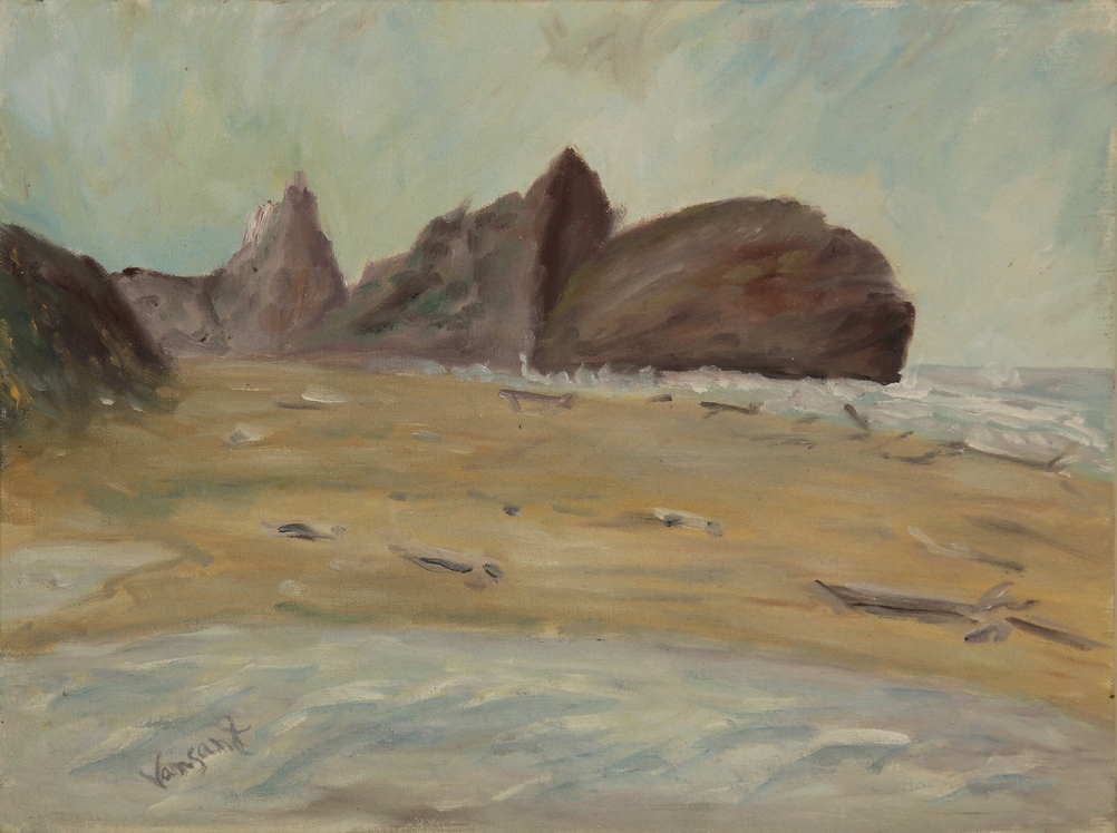
#196 Pistol River Beach View 12x16
About 1:19 I moved on south towards Brookings, first stop the Brookings Rest Area Info, then the post office and then a longer stop at the Azalea State Park. Next across the river to the Boat Basin and stopped by the day use RV parking, Ihad been looking for hot showers and found them there.
Treated myself to a coffee and donut at the Brookings Beach Bakery-$ .55 total and ended with a meaty tostado and Dr. Pepper at Taco Ole-$1.55.
A little before 6:00 I headed inland to the Siskiyou National Forest and stopped at the Little Redwood Creek Campground for the night. I spotted a Dipper bird (first time I saw one) in the creek and he was dippping up and down as he walked around the creek bed.
Oct. 3, 1981-Saturday: Day 38 Exploring the Forest then Back to the Beach
Without the original map it is hard to tell where exactly I went to in the forest but I headed further inland on what I thouht was a circular route but realized I had to return the way I had come. I was able to ID a Scrub Jay and a Stellars Jay in the process. On the way back I saw an old shack and did a painting of it. Not far from there I hiked the Redwood Nature Trail.
Then being late afternoon I headed back to Brookings and went to McKay's Grocery store for supplies and then back north to Harris Beach State Park. Another Mexican meal at Robin's and at 8:42 I parked for the night north of Brookings off 101. 50.9miles for the day.
Oct. 4, Sunday: Day 39 Mostly Chores Today
Got up and at 8:48 drove back to Harris Beach State Park. It was time to completely clean out the the inside of the van and rearrange things more conveniently. Every once in awhile I realize I need to make a more optimized arrangement of those things I am currently using more often and store other things away. When you are living in a small space you want to be more efficient.
While I was there I saw a Killdeer and I think a Winter Wren. Then I set up and painted a picture of the shore and rock formation.
While I was there I saw a Killdeer and I think a Winter Wren. Then I set up and painted a picture of the shore and rock formation.
#198 Coastal Rocks-Harris State Beach, Brookings, OR 12x16
#197 Old Shack-Siskiyou Nat. For, OR 12x16
About 6:30 I headed to the Brookings Boat Basin where I had scouted out the hot showers the day before where I shaved and got a shower. Next on my schedule was dinner at the Red Barn: eggs, toast, tea and ice cream for desert-$2.50 plus .50 tip. Then final task of the day was doing my laundry at the Econowash: wash-.60 and dry-.50. Parked at the same spot as the night before for the night. Low mileage day-13.2.