July 18, 1980 Day 24 Bathurst to St Quentin
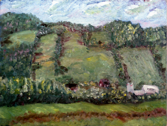
I did a watercolor sketch and then an oil on masonite of the cliffs and a barn. It was time to get cleaned up and I had seen a natural flow of water out of the cliff face so i got my soap and shampoo and went down for a shower-not hot and cold controls, but I'm used to cold water.
Headed north and stopped in Bathurst by the harbor. After going across the bridge to a shopping center for groceries-2 bananas, whole wheat bread and thuringer wurst, it was on to Charlo where I did another watercolor sketch. Stopped in Robinsonville and then on to St. Quentin where I went to a cafe for coffee and shortcake. There is much more french in Canada then I learned in school where they usually only talked about Quebec, but here in New Brunswick french was predominant. About five miles further down the road I found a rest area to stop at for the night.
Headed north and stopped in Bathurst by the harbor. After going across the bridge to a shopping center for groceries-2 bananas, whole wheat bread and thuringer wurst, it was on to Charlo where I did another watercolor sketch. Stopped in Robinsonville and then on to St. Quentin where I went to a cafe for coffee and shortcake. There is much more french in Canada then I learned in school where they usually only talked about Quebec, but here in New Brunswick french was predominant. About five miles further down the road I found a rest area to stop at for the night.
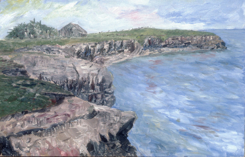
Old Barn and Cliffs on Nepisquit Bay 13x20
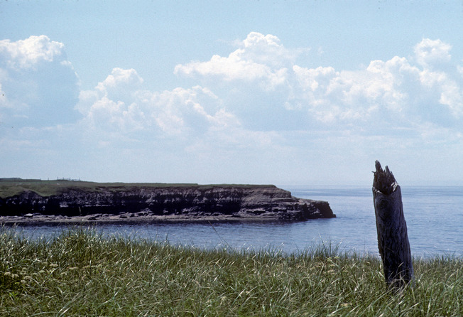
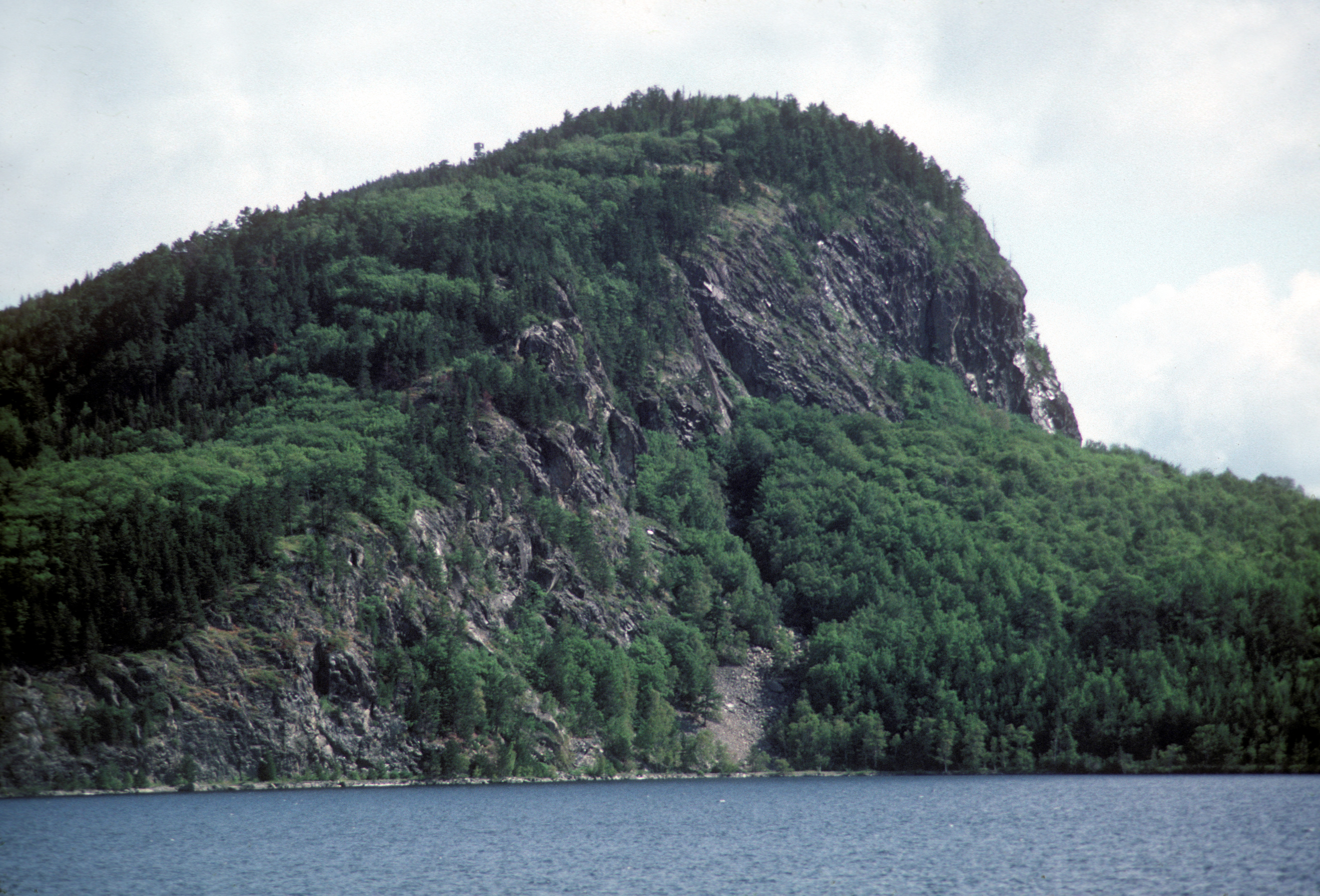
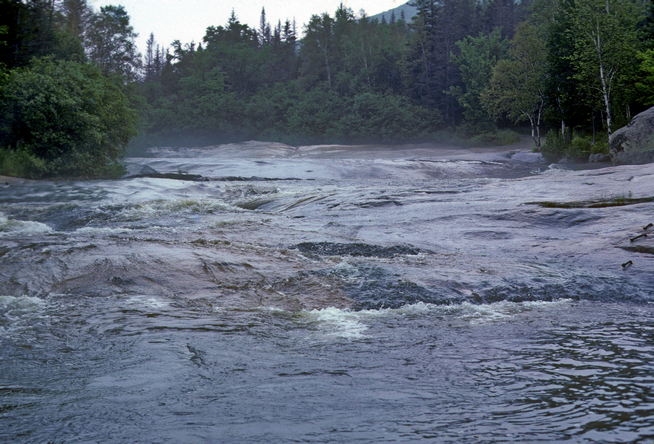
Rocky Cliffs
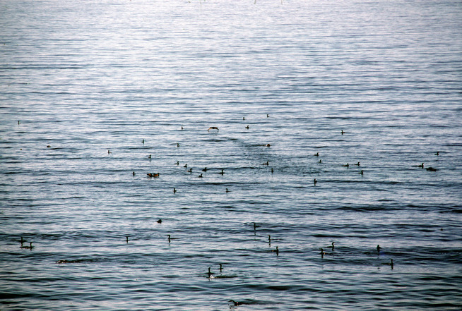
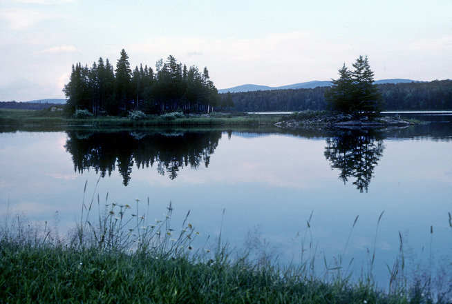
Loons on Nepisquit Bay
July 19, 1980 Day 25 Back to Far North Maine
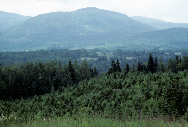
View from My Night Spot
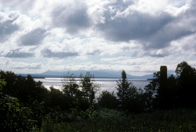
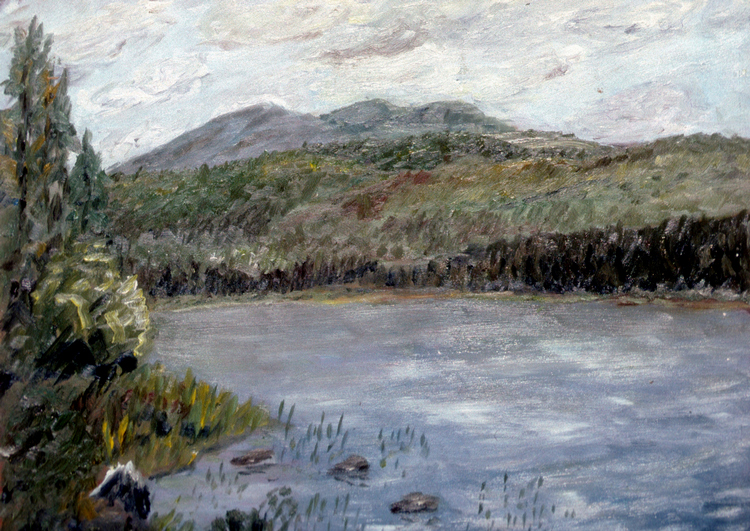
View of Canada Across the St. John River 12x16
July 20, 1980 Day 26 Surviving a Perilous Hazard
I spent some time rearranging things and did a general cleanup and
swept out the van. It took several days into the trip to know what I
needed most and easiest to get and then every few days the arrangement
was refined until it became much more efficient. I washed up at the
handpump, I wasn't in a hurry because there had been a thunder storm
last night and everything was still pretty hazy. I did one watercolor sketch
and then headed south. I stopped first at the southwest corner of Eagle
Lake and then further along I went 6 miles back a logging road off of 11
and stopped out in the middle of nowhere. I took a walk, saw a winter
wren and did tai chi.
Back on 11 north of Ashland I saw an old house by the road I wanted to
do a painting of. There was a river across the road with a flat section along
it that was down a dirt incline about 45 degrees and 15 foot below the
highway. I checked it out and it was hard packed and showed it had been
used fairly often by vehicles to get down to the river. It was only about 10
to 12 foot wide but seemed safe enough, so down I drove and set up to do
a painting. After about an hour a light drizzle started but I didn't worry
and kept on working, later thinking being so close to the water level of the
river may be dangerous as the rain was picking up and it could be a flash
flood area. So I loaded up and started up the incline, but the dirt was clay
and the rain had made it slippery so I slid back down. I backed up as far as
I could and tried to build up some momentum which was difficult because
at the base of the incline was a half foot depression in the ground that
slowed me down. And as I tried a couple more times I started slippping
back sideways twisting towards the edge of the incline which was an
absolute dropoff. Now I knew if I didn't get out soon I wouldn't be able to
and I had no idea how much the river would rise being only about 6 inchs
below the bank. So the next time I knew I didn't worry about any of the
gear getting out of place revved it up and didn't slow down at he
depression and sliding back and forth close to each side I climbed up and
was able to get the fornt wheels on the road and slowly at this point made
enough progress to make it all the way up and when I got over on the
shoulder I turned to see what I had heard as everything had been flung off
the shelves and I had a lot of straightening up to do again. I went on
south a little and parked by on an old bi-pass road near Sherman, glad my
van at least didn't become a boat.
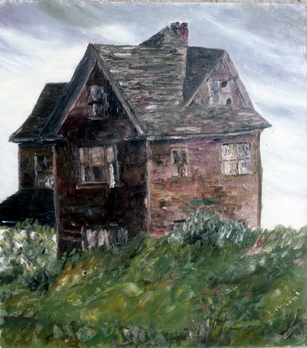
Old Abandoned House by the Road 18x16
July 21, 1980 Day 27 Baxter State Park Dump
Stopped at Seboes River campsite on road to Baxter State Park and did some birdwatching and then a watercolor sketch. Entered Baxter State Park at Matagamon entrance. All campsites taken so I had to figure out where I could stay without leaving the park. Noticed work road that led to gravel pit-dump and stayed there for the night. Mt. Katahdin is in the park, the highest point in Maine and I am planning to make the hike up tomorrow.
July 22, 1980 Day 28 Mt. Katahdin-Highest Point in Maine
After a stop for breakfast I went to a place called Ledge Falls, wich was a fantastic area where the river passed over 150 feet of solid bed rock sculpting out terraces. Went on to Abol Campground and parked for the hike up the mountain to Baxter Peak. They had a sign about leaving yourself enough time to get up and back and I was always worried with an unfamiliar hike whether I would make it or not, and that was how it was then. So I started up and it wasn't too difficult, but I could't gauge how long it would take me and if it would be trouble coming back down. Then about half way up I passed a family with a couple elementary school kids just taking their time and I realized it wasn't going to be too difficult. I had left at 10:15 and arrived at the top at 12:39. It was beautiful and what made it more impressive was the fact that it was just like it was when Thoreau hiked up the mountain. Not only is it the highest point in Maine, it is also the northern end of the Appalachian Trail.
I generally think all politicians are scoundrels and thieves but Governor Baxter, who gave the original land to the state for the park knew what he was doing because he gave it with the stipulation that no roads could ever be built on it which was very wise, especially if you compare it with one of the other main New England peaks-Mt. Washington which I will write more about the contrasts when I get to that entry. I did taichi at the edge of the plateau on the way down. When I got back down I returned to Ledge Falls and went in the water, which was about 2 to 3 feet deep, cool, clear and refreshing with a strong current. I left the park by the Nesowadnehunk entrance and took a private road until I reached the Ripogenous Dam cutoff and parked for the night. 45.8 miles for the day, expenses an average of $12.73 per day for 28 days
I generally think all politicians are scoundrels and thieves but Governor Baxter, who gave the original land to the state for the park knew what he was doing because he gave it with the stipulation that no roads could ever be built on it which was very wise, especially if you compare it with one of the other main New England peaks-Mt. Washington which I will write more about the contrasts when I get to that entry. I did taichi at the edge of the plateau on the way down. When I got back down I returned to Ledge Falls and went in the water, which was about 2 to 3 feet deep, cool, clear and refreshing with a strong current. I left the park by the Nesowadnehunk entrance and took a private road until I reached the Ripogenous Dam cutoff and parked for the night. 45.8 miles for the day, expenses an average of $12.73 per day for 28 days

In Baxter State Park
Baxter State Park View
Ledge Falls
I got up and did tai chi then a watercolor sketch. My first stop was in Edmunston and I parked up town where I spent about a half hour. Then leaving Canada having driven about 532 miles while I was there, I went west on 1 past upper Frenchville and at a rest area painted a view of Canada across the St. John River. Years later when I was living in Norfolk, Virginia I met a lady who was from Madawaska, right down the road from here and I gave her the painting. I ended the day by stopping at the Soldier Pond rest area on 11. Total mileage so far 2869.3, average daily expense $14.06.
July 23 1980 Day 29 Moosehead Lake
I moved a short distance from my night spot and had breakfast and
then did taichi on a big rock in the river. Next I started a painting of the
river but it began to rain so I had to give it up. I took a bucket shower on
a rock in the river. After the incident with the leeches in Massachusetts I
was leery of going in any strange bodies of water, especially since I
didn't have anyone to pick them off of me. What I did was cut the top off
of a plastic gallon milk carton leaving the handle then by standing next
to body of water or sometimes partially in it I could get a good dowseing
dipping the carton into the water and then dumping it over my head. All
cleaned up and ready for civilization I headed on to Greenville, stopping
at the A&P, getting gas and mailing a postcard. I parked at the
Greenville Junction boat ramp for dinner and my last stop for the day
was by the river off of the road near Moosehead. 56.8 miles for the day,
3130.9 miles so far on the trip, expenses of the day $9.31

Stream at Ripogenus Dam 16x20
July 24, 1980 Day 30 My First Moose and Back to Canada-Quebec
After taichi I headed in to Rockwood taking photos on the way. Short
stop at Brassua Lake where I found a nice piece of white quartz. I
knew I would be leaving Maine shortly and I was getting worried
because I had always associated it with moose and even after all the
time in the back woods I hadn't seen any, then as I was driving 6 to
Jackman with Long Lake to my right, there they were. A female and a
young one crossing the road, driving my forest speed about 25-30
miles per hour it didn't take much to stop and after jumping out I could
see them in the trees although they blended in very well. Now I had
really seen Maine and could leave with a sense of achievement.
After a short stop at Jackman it was on to Canada again and the first
stop was St. Georges. It was somewhat of a frustrating day because,
headed in the direction of Quebec City, I was trying to get to see some
of the river and water spots along the way but they were all private. I
did get to my first Canadian Dunkin Donut in Lewes-coffee and donut
70 cents. Wow , I'll have to move here. Got into Quebec City late and
found a spot for the night by an apartment house. I covered too much
ground and didn't see enough for the mileage.

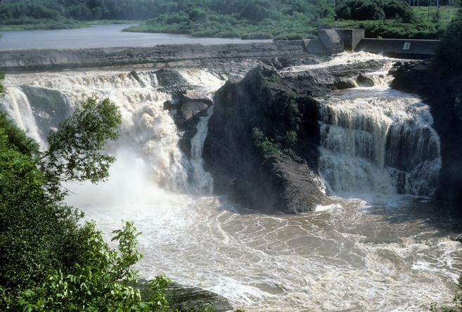
Ledge Falls
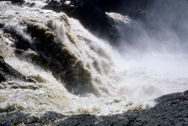
Dam and Falls on to Road to Quebec
July25, 1980 Day 31 A day in Quebec City and then Lac St Francis
After leaving my night spot I went and parked on Boulevard Champlain
near the ferry depot. I did some sketches and walked around the citadel and
old town area. The area had more of a European air to it more than anywhere
I've been in the US. After walking for awhile I reached an area with a
panoramic view and there were two old guys with french easels painting the
scenes below, and this seemed to be the way they spent their days. This
would be great. To find a place that I could paint with a variety of motifs,
within walking distance from where I lived, near a cafe or coffee shop and
paint pictures to sell to the tourists, perhaps with a kindred spirit to pass the
time and chat as we painted. After several hours walking around and
sightseeing I departed going first to St Nicoles and having a couple beers
($1.10 wow this is like Germany where beer is a normal drink and not hyped
up and overly expensive). I ended the day parking by the dam below Lac St.
Francis, where I was able to take a bucket shower and get properly cleaned
up after two days of travel.
July 26, Day 32 Back to the US and Meet Some Locals
Did my taichi then headed southwest, making my first stop at a rest stop
in Garthby. Then on to Scotstown by the dam and did a watercolor sketch.
Took a photo at a rest stop before LaPatrie and then at the Coop store in
LaPatrie for gas and bread. After entering New Hampshire I stopped at a
picnic area and boat launch at the north end of Second Connecticut Lake.
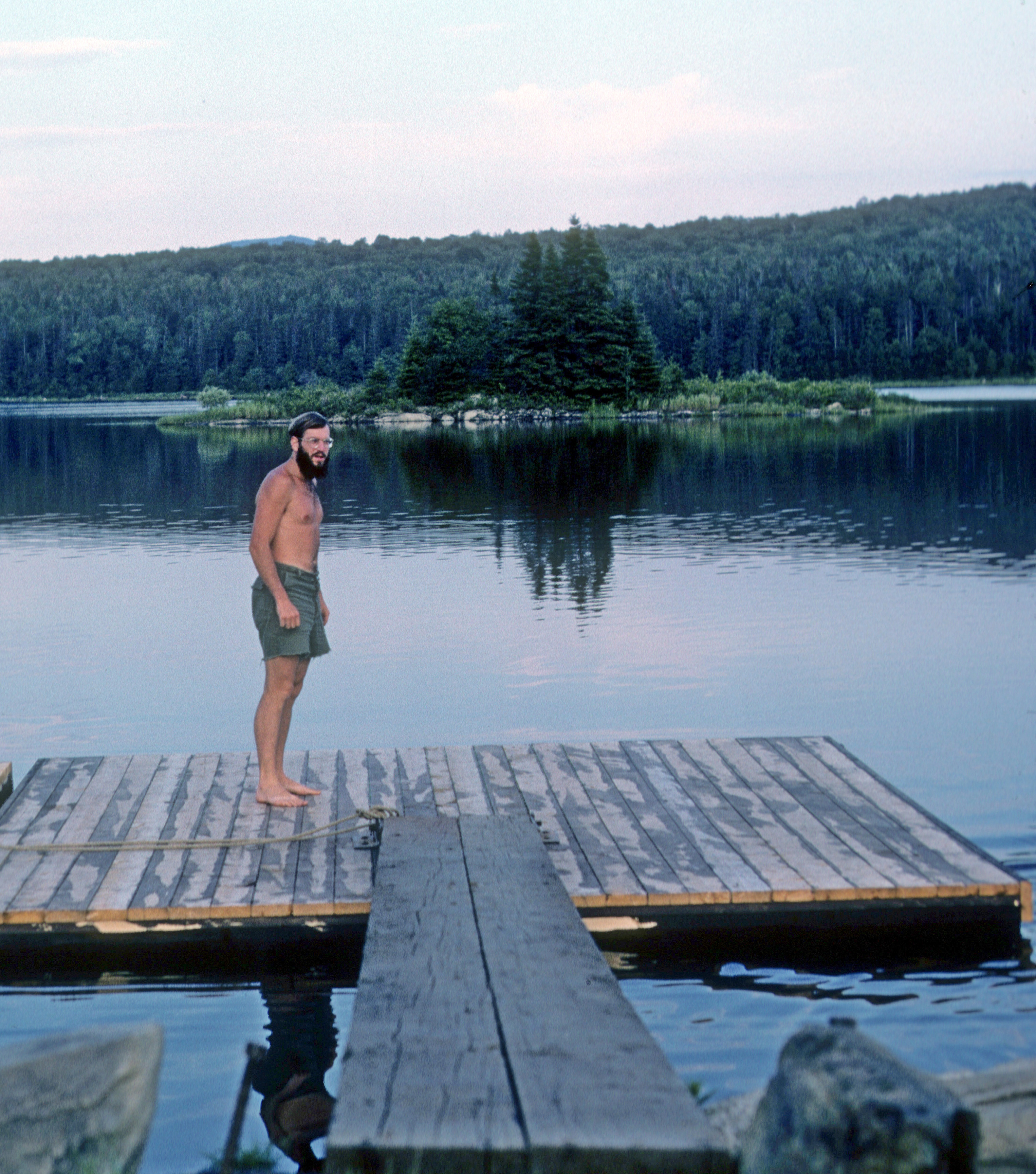
Here I did a painting of the opposite shore and took a rare photo of
myself on a pier. I met the Backers while I was painting and they invited
me to stay in their driveway a little to the south on Back Lake. So after I
was done I headed on down there and went swimming in the pond and
stayed the night.
View of Second Conneticut Lake 14x18
Southern Quebec
Second Conneticut Lake
On Second Conneticut Lake
July 27, 1980 Day 33 South then East Across Vermont to Lake Champlain at Swanton
I got up and had breakfast with my hosts and got a late start on the road. I passed a waterfall off route 145 and later realized I should have stopped because that was the best scene of the day. So that is a thing to keep in mind when you travel-to me the trip is more important then the destination. Some places you are really looking forward to are a disappointment or as I found a lot of the time with art museums including the Louvre-the particular galleries I wanted to see were closed for renovation. Anyway I stopped at the Westmore Beach public swimming area on Lake Willoughby. I did some sketches and a watercolor sketch and then went swimming. I headed for Hazen's Notch, a high point on 58 a back dirt road. The Long Trail crossed the road at the Notch. I had stopped at a sign that said Balance Rock but it was not too interesting and it was too cloudy for any good views. I reached Lake Champlain near Swanton and took a bath and had dinner. Then I went into Swanton to a carnival. Went back to beach area road for night. statistics: 3726.1 miles on trip so far, current expense average $12.35 per day
July 28, 1980 Day 34 Mt Mansfield-Another State Highest Point
I walked down to Lake Champlain again and then left by following the
lake south until I headed inland to Georgia Center and through
Jeffersonville to the Smuggler's Notch information booth, where I stopped
for awhile. A lot of notches around here. With my info I went to a real nice
picnic area at the base of Mt. Mansfield where the Long Trail crosses the
road. I hiked up the Long Trail to Chin Peak starting at 11:20 and arriving
back at 14:30, a one way distance of 2.3 miles and a fairly easy hike. After
refilling my water container, taking a bucket shower at the spigot and
doing taichi, I headed south to Montpelier. On the way I stopped by route
2 past Waterbury to have a sandwich and do a watercolor sketch. Arriving
in Montpelier about 7:30 I walked around the downtown looking for a
laundromat and after finding one I moved the van there, I did see the
state house but there are priorities. It was pretty late too look for a spot
when I got done so I returned to a commuter lot near Middlesex I had
seen.
July 29, 1980 Day 35 Back to Montpelier and then Back to New Hampshire
I went back to Montpelier to see the Wood Art Museum, but it opened
late and was a waste of time. Headed back towards New Hampshire for
another New England highest point, stopping at Sabin Pond on route 14
for lunch and a rest. Then on to St. Johnsbury where I stopped on main
street and looked for the Athenaeum Art Gallery. It was in the library and I
was mainly impressed with a painting by an unknown French landscape
painter. The rest was not too spectacular. Next a Dunkin Donut stop-
haven't been to one of these in several days. Took route 2 across a bridge
into New Hampshire and parked by a field to take a photo. I went to a
laundromat in Groveton to dry my laundry from the night before,
sometimes I just wash it and try to let it finish drying in the van to save
money but because of the rain and dampness it was still not dry. I parked
by the river on an old road parallel to 110 for the night. I had a bucket
shower by the stream and tried to do taichi but the mosquitos were too
bad so I went to bed. I had made screens for all my windows that I could
attach with velcro (the two back door pop-open windows, the front
driver side and passenger windows which I could roll down all the way or
partially, and I had two roof vents that had fans) so I didn't suffer from
any bugs usually inside the van.
July 30, 1980 Day 36 Jefferson Notch-A Different Kind of Highest Point
Did tai chi then a watercolor sketch. Moved on east, stopping at a picnic
area but it wasn't too scenic so went on to Berlin. Stopped at Dunkin Donut
and had two donuts with coffee-must be carbohydrate loading for hike up Mt.
Washington tomorrow. After checking out a shopping center that was a waste
of time I went to route 2 near the entrance to Valley Road (must be near
Randolph) and did a painting on masonite 16x20 which is a lot to finish in one
sitting. It was of the Presidential Range to the south and while I was painting
it looked like a rescue helicopter was coming back from the mountains with a
stretcher. If you've read about Mt. Washington it is supposed to be one of the
most treacherous climbs because of the change in weather from the base to
the top with many sudden storms coming in. I finished my painting and
headed for Jefferson Notch Road. I found a stream by the road where I could
get cleaned up and then passed Jefferson Notch to go to the Base Station by
the trail to see how far it was and parking etc. Then I returned to Jefferson
Notch, elevation 3007, and as I remember it was billed as the highest through
road in the state, not that much was going through it. So I spent the night by
the side of the road on the highest spot of the highest through road in the
state. You didn't hear any of the sounds of civilization up there but it was
either dripping rain from the heavy cover of trees across the road(just a
narrow dirt one) or there were animals jumping on my roof all night. Probably
not the latter, but I did climb up to look in the morning to see if there was
anything there or possibly claw marks on it.
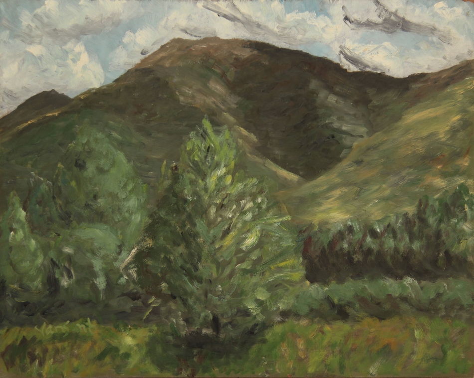
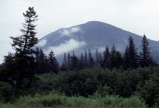
View of Presidential Range
July 31, 1980 Day 37 Hike to Top of Mount Washington-Another Highest Point
Did taichi and then went and parked below the pay parking lot at the
base station. The weather was nice at the bottom with some clouds to
be seen, but warm and no wind. I was aware of the dangers so I
planned ahead and started hiking up the road to the access path. The
weather lived up too it's reputation turning to thick fog and wind as I
ascended with the temperature diving down to about 50 and fog turning
to rain. I was dressed in shorts and a teeshirt with my backpack and
although I got the impression from people I passed that they thought I
was not too bright because of the circumstances, I was fine. Going uphill
you generally generate so much body heat that you stay plenty warm,
although I was soaking wet and there wasn't any view. If I had worn
more clothing I would have been as wet from sweat and dehydrated.
The problem would of been at the top when I would cool off quickly and
be subject to exposure problems. However I had a dry tee shirt and
pants plus a rain coat in my pack plus a towel and after drying off and
changing in the visitor center bathroom I was feeling great.
Now for my comparison of Mt Washington and Katahdin that I wrote
how Governor Baxter gave with the stipulation of no roads being built.
When I hit the top it was awful-tv and radio towers, tractor trailers, a
traffic jam in the parking lot, noisy vehicles and honking horns, the cog
railroad station, utility buildings, plus the visitor center, this wasn't
getting back to or enjoying nature. It's a problem. When you develop an
area so more people can enjoy it you usually destroy what was most
attractive about it. It took me two hours and two minutes to hike up,
never cleared up for any nice views. I did meet an older gentleman who
came with his much younger daughter both at their own pace and they
met again at the top, she likes him to do things with her and it doesn't
bother either of them that he can't keep up with her pace, good attitude.
I started back down and stopped at the Lake of the Cloud Lodge and had
some soup, $.60 back then.
After getting back down I moved to the cog railway historic marker.
Wrote a postcard and added a quart of oil to the van. Heading out I
stopped by a pond after turning on to 302 and walking around the pond
I saw a beaver hut and beaver. I did a real quick painting of the hut and
lake which didn't turn out to well. Next stop Crawford Notch State Park
at a free picnic area, it had a really nice view along the highway. Further
on I stopped next to a bridge on the road and was able to go underneath
it and take a barebody bath and shower. There was a really beautiful
view near North Conway, which I at some time did a painting of from a
photo. Years later when I went to the University of Michigan Art Museum
I saw two paintings from almost exactly the same spot and I have seen
others in books. This was a really popular spot for 19th century
landscape painters. When I reached the Kancamagus Highway I
followed it to Bartlett crossover and parked on a closed road for the
night. After doing taichi again I went to bed-long day.
Beaver Hut and Lake 12x16
View near North Conway, NH
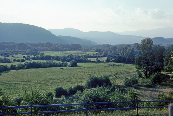
Fields and Mountains-North Conway, NH 20x25
Augest 1, 1980 Day 38 Back to Vermont Ending Near Hartland
Did tai chi and then traveled further on the Kancamagus Highway. The
valleys of this area from yesterday and today turned out to be much
more scenic than on top on Mt. Washington. I stopped at Sugar Hill
Scenic View and did a watercolor sketch, then moved down the road
about 3 miles to Lilly Pond where I did a quick oil painting. I put in a
good bit of mileage today, my next stop was Enfield by the boat launch
and had a sandwich. Next to Lebanon for groceries and to a Dunkin
Donut in North Lebanon. I crossed into Vermont and got gas at Hartford
then south to North Hartland, the resevoir area by the boat launch
where I went in swimming. I was surprised to find the water warm
which was nice. I ended the day in the commuter parking lot next to 91
on 5 past Hartland. 123 miles for the day-too many miles to see
enough. 4143.4 miles so far and average expense per day $12.38
getting low on money
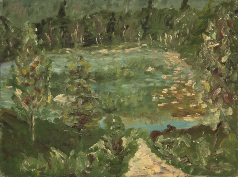
Lilly Pond 12x16